Marlow@Sea · Salty Library & Rituals
Vatican Maps
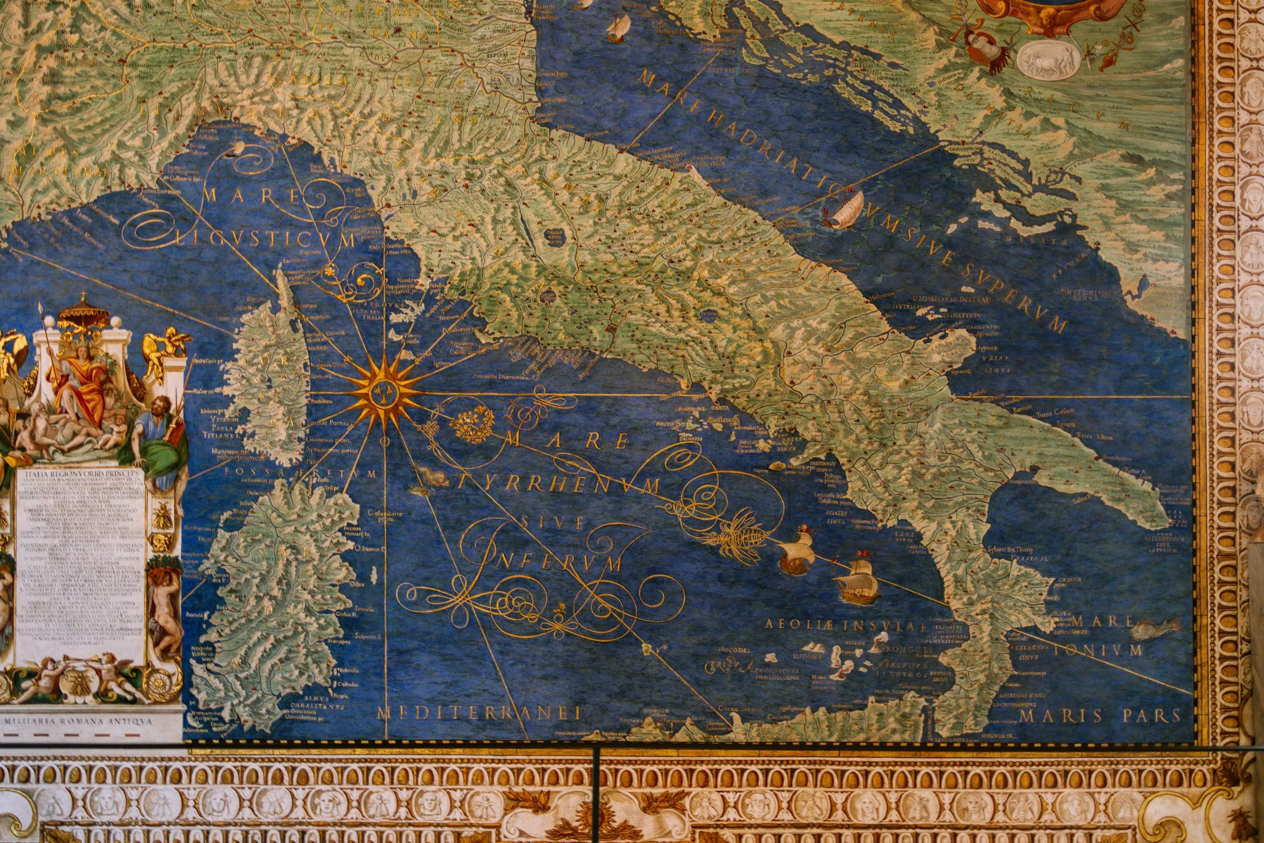
From the Vatican Gallery of Maps Atlas by Franco Cosimo Panini detailing 40 maps of Italy painted in the Vatican in the late 16th century.
Marlow's Mediterranean · 2007–2010

The Vatican map of Italy focused on the territory covered by Marlow from 2007 to 2010.

In the summer of 2007, after crossing the Atlantic and sailing along the French Riviera from Marseilles, Marlow arrived in Antibe on its way to Nice, Monaco, and San Remo with the family crew of Mike, Eliza, Anna, Ella, and Jemima + John Middleton.

Facing south, sailed from Nizza (Nice) to San Remo (right to left).

From San Remo across the Gulf of Genoa at night to Portofino and ultimately La Spezia where Marlow was laid up on the hard for 2.5 years.

In 2010, Mike, Middleton and Hunt sailed from La Spezia to Tunisia, with stops in Elba and southeast Sardinia.

Cosmopolis, Elba


Southeast coast of Sardinia

In 2010, after returning from Tunisia to Ostia, the port of Rome, as it appeared in the time of Emperor Claudius, 41–54 CE. The family crew + Middleton sailed north from Ostia along the Italian coast to Puerto Ercole.

Puerto Ercole, on the east side of the peninsula.

From Puerto Ercole to Bonifacio, Corsica.

From Bonifacio to Puerto Vecchio, looking south.

From Corsica to northeast Sardinia, including Puerto Cervo and surrounding islands.

Back to Rome from Sardinia, and then down the coast of Italy to Ponza on our way to Napoli.

Island of Ponza

Naples, with a stop in Ischia (top right).

Zoom in Napoli.

In Napoli, we depart Marlow which will sail for Mallorca to be laid up again.


The Battle of Lepanto (1571).